Maps and Maths

Saturday 22 September 2018

Map Skills

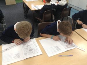
Not only are we learning to recognise OS map symbols, but children practised an extra maths skill by measuring the distance between two places on a map.

We studied a map of our local area and identified places of interest: our school, the nearest petrol station, picnic areas and parks. The children found particular place names quite amusing, such as Bog Lane and Flying Horse Farm!

To support our learning of our local area, we used a fantastic website called Digimaps for School.

Privacy Overview

This website uses cookies so that we can provide you with the best user experience possible. Cookie information is stored in your browser and performs functions such as recognising you when you return to our website and helping our team to understand which sections of the website you find most interesting and useful.

You can adjust all of your cookie settings by navigating the tabs on the left hand side.

You can read our full privacy policy, which includes information on the cookies this site uses on our Privacy Policy page